
Navigating Britain's roadways has become increasingly complex as new regulations and technological requirements reshape how we drive. With substantial changes coming into force over the next few years, motorists face fresh challenges that demand attention, particularly regarding how navigation systems interact with evolving speed limit enforcement. Ensuring your sat nav reflects current road conditions is no longer merely a matter of convenience but a critical component of legal compliance and safe driving across the United Kingdom.
Why Keeping Your Sat Nav Current is Absolutely Critical for British Motorists
The relationship between your navigation device and legal compliance has transformed dramatically in recent years. British motorists increasingly rely on satellite navigation systems not just for directions but for real-time information about speed restrictions, and this dependence carries significant legal implications. The introduction of Intelligent Speed Assistance systems in new vehicles represents a fundamental shift in how speed limits are monitored and enforced. From July 2024, all new cars appearing in showrooms must feature speed limiters, technology that actively prevents vehicles from exceeding posted limits through a combination of traffic sign recognition cameras and GPS location data. These systems determine the appropriate speed for your location and respond accordingly, either by making the accelerator pedal harder to press, displaying prominent warnings, or gradually reducing your speed as you approach the threshold.
The legal implications of outdated navigation systems
Whilst the government has invested billions in road infrastructure and traffic management improvements, including thirty million pounds for traffic signal upgrades and twenty million for artificial intelligence programmes designed to optimise traffic flow, drivers themselves bear responsibility for ensuring their navigation equipment remains current. The consequences of relying on obsolete map data extend beyond simple inconvenience. When your GPS contains outdated speed limit information, it may display incorrect restrictions, potentially leading you to drive at speeds that exceed newly implemented limits. Although you can override the speed limiter by pressing the accelerator firmly, doing so when your navigation system displays incorrect information creates a particularly problematic situation where you might unknowingly violate current regulations.
How incorrect speed data could land you in hot water
The enforcement landscape has grown considerably stricter, with authorities cracking down on various motoring offences with renewed vigour. In London alone, more than seven million penalty charge notices were issued in the year ending March 2022, representing a forty-one percent increase on the previous year and a twenty-one percent rise compared to pre-pandemic figures from 2019 to 2020. Police have intensified efforts to identify illegal number plates, targeting incorrect spacing of letters and numbers, unauthorised backgrounds such as carbon effect designs, and tinted plates, each violation carrying a one hundred pound fine. Within this heightened enforcement environment, speeding remains a primary concern, particularly as statistics reveal that fifty percent of cars exceed limits in thirty mile per hour zones and approximately one third of road fatalities result from excessive speed. Relying on navigation equipment that displays incorrect speed limits compounds the risk substantially, as you may inadvertently exceed restrictions whilst believing yourself to be compliant based on outdated information.
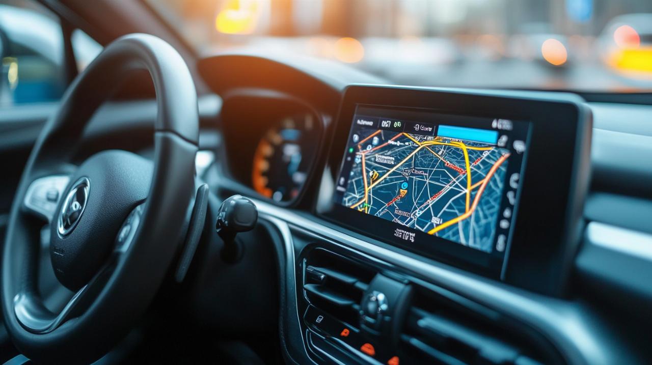
Step-by-step: refreshing your gps maps and speed limit database
Updating your navigation system requires a methodical approach, though the specific process varies depending on your device manufacturer and model. Most standalone sat nav units and integrated vehicle systems periodically release map updates that incorporate recent changes to speed limits, new road layouts, and modified traffic regulations. The frequency of these updates typically ranges from quarterly to annual releases, making it essential to establish a regular checking routine. Electric vehicle owners should pay particular attention to navigation updates, as these often include information about charging infrastructure, which continues to expand rapidly with over forty-eight thousand public chargepoints available as of September 2023, representing a substantial forty-three percent increase from the previous year.
Connecting Your Device via USB and Accessing the Proper Software
For many navigation systems, the update process begins with establishing a physical connection between your device and a computer. Most manufacturers provide dedicated software applications that facilitate the transfer of new map data and speed limit databases. Begin by visiting the official website of your GPS manufacturer and locating the support or downloads section. You will typically need to create an account or log into an existing one, then download the appropriate desktop application for your operating system. Once installed, connect your navigation device to your computer using a USB cable, ensuring the connection remains stable throughout the update process. The software should automatically recognise your device and display its current software version and map database information. From this interface, you can check for available updates and initiate the download and installation sequence.
Downloading the Latest Map Data for Your Renault or Other Motor Vehicles
Integrated vehicle navigation systems, such as those found in Renault models and other modern cars, often follow a slightly different update procedure. Many manufacturers now offer updates through SD cards, USB drives, or increasingly through wireless over-the-air updates that download directly to the vehicle when connected to Wi-Fi. Check your vehicle handbook or the manufacturer's website for specific instructions tailored to your model and year. Some systems require you to input your vehicle identification number to access the correct update files, ensuring compatibility with your specific hardware configuration. The download process can take considerable time depending on the size of the map database and your internet connection speed, with some updates exceeding several gigabytes. Once downloaded, follow the on-screen prompts to install the update, which may require the vehicle to remain stationary with the ignition on for an extended period whilst the new data transfers and installs.
Maintaining your navigation system: regular updates and best practices
Establishing a consistent maintenance routine for your navigation equipment helps ensure you always have access to current road information. The government continues to implement changes across England's strategic road network, backed by twenty-four billion pounds of investment between 2020 and 2025, alongside over five billion pounds dedicated to maintaining local road networks during the same period. These investments result in frequent modifications to road layouts, speed limits, and traffic management schemes that your navigation system must reflect to remain useful and legally relevant. Setting calendar reminders to check for updates every three months provides a reasonable balance between staying current and avoiding excessive time spent on maintenance tasks.
Setting Reminders to Check for New Map Releases and Speed Limit Changes
Beyond scheduled checks, remain alert to announcements about significant road changes in your area. Local authorities increasingly implement Low Traffic Neighbourhoods, modify twenty mile per hour zones, and adjust bus lane configurations, all of which affect navigation accuracy. The government has updated guidance on these schemes, emphasising the importance of local support and preventing blanket implementations that lack community backing. Subscribing to newsletters from your GPS manufacturer ensures you receive notifications when critical updates become available, particularly those addressing safety-related changes or correcting errors in speed limit data. Some manufacturers offer subscription services that provide unlimited map updates for a fixed annual fee, which may prove economical if you drive frequently across diverse regions or if your vehicle came with only a limited period of free updates.
Alternative methods: mobile applications and computer-based solutions
Smartphone-based navigation applications present an alternative or supplement to dedicated GPS devices, offering the advantage of more frequent updates delivered automatically through standard app update mechanisms. Popular applications refresh their map databases regularly, incorporating user-reported changes and official data sources to maintain accuracy. However, reliance solely on mobile applications carries risks, including potential signal loss in areas with poor reception and battery drain during extended journeys. Many drivers adopt a hybrid approach, maintaining both an integrated or standalone GPS system and a smartphone application, using each to verify information from the other when uncertainty arises. Computer-based route planning tools allow you to research journeys in advance, identifying recent speed limit changes along your intended route and preparing for new restrictions before you depart. As the number of plug-in vehicles in the United Kingdom has risen to over one point two million, with seven hundred and seventy thousand fully battery-electric models, journey planning increasingly incorporates charging stop locations, making pre-trip computer-based research even more valuable. Whichever method you choose, the fundamental principle remains consistent: accurate, current navigation data serves as an essential tool for legal compliance and safe motoring in an increasingly regulated driving environment.